
The product
The digital rally navigation cockpit.
Roadbook. CAP. Odometer. Waypoints. Speed zones. Everything you need to navigate a stage, on a device you already own.
RallyBook isn't on the app stores yet. Tell us what you're training for and we'll get you a build.
hello@rallybook.app- CAP
- 312°
- DTW
- 4.2km
Roadbook
The stage, case by case.
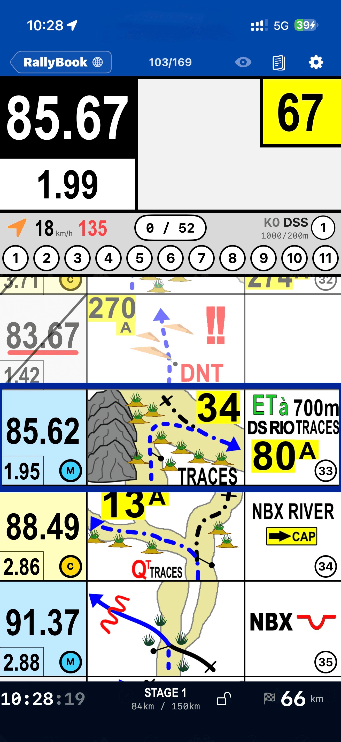
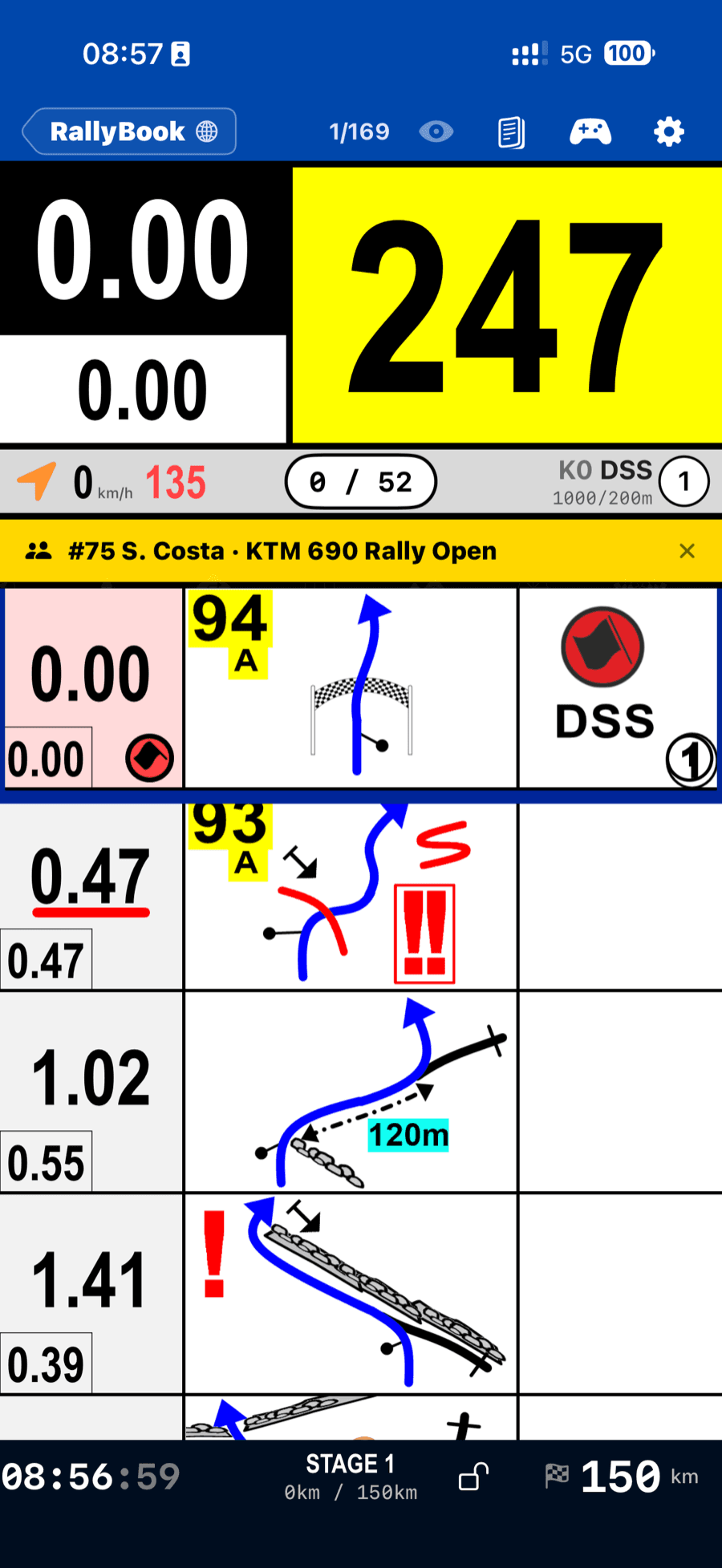
A layout designed for navigating rather than reading: distance, tulip and notes in the proportions a rider scans at speed. Section headers, zone markers and danger levels are carried through exactly as the roadbook author drew them.
- GPX
- From any rally planner, with tulip images and notes intact
- Scanned or exported roadbooks, page by page
- .CAP
- Encrypted stages from RallyCAP
CAP
Heading, live, where you can read it
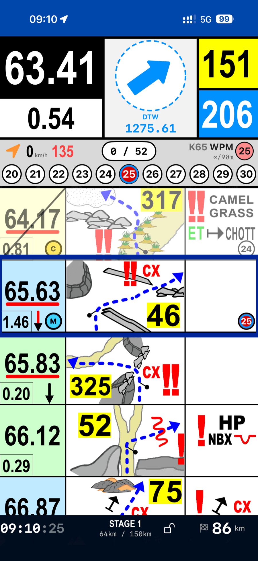
The CAP display stays legible on a moving bike, alongside the bearing to the waypoint you are running on. Heading comes from your trajectory, which is what matters at speed.
Waypoints
Validation you don't have to think about
Enter the radius and the waypoint validates itself. The state carries through the stage (validated, missed, or still ahead) and a missed waypoint tells you, rather than passing in silence.
- Automatic validation on entering the zone
- Manual selection when you need to override
- FIA-style radii, configurable per roadbook
- Missed-waypoint alert with audible warning
Odometer
Precision distance control
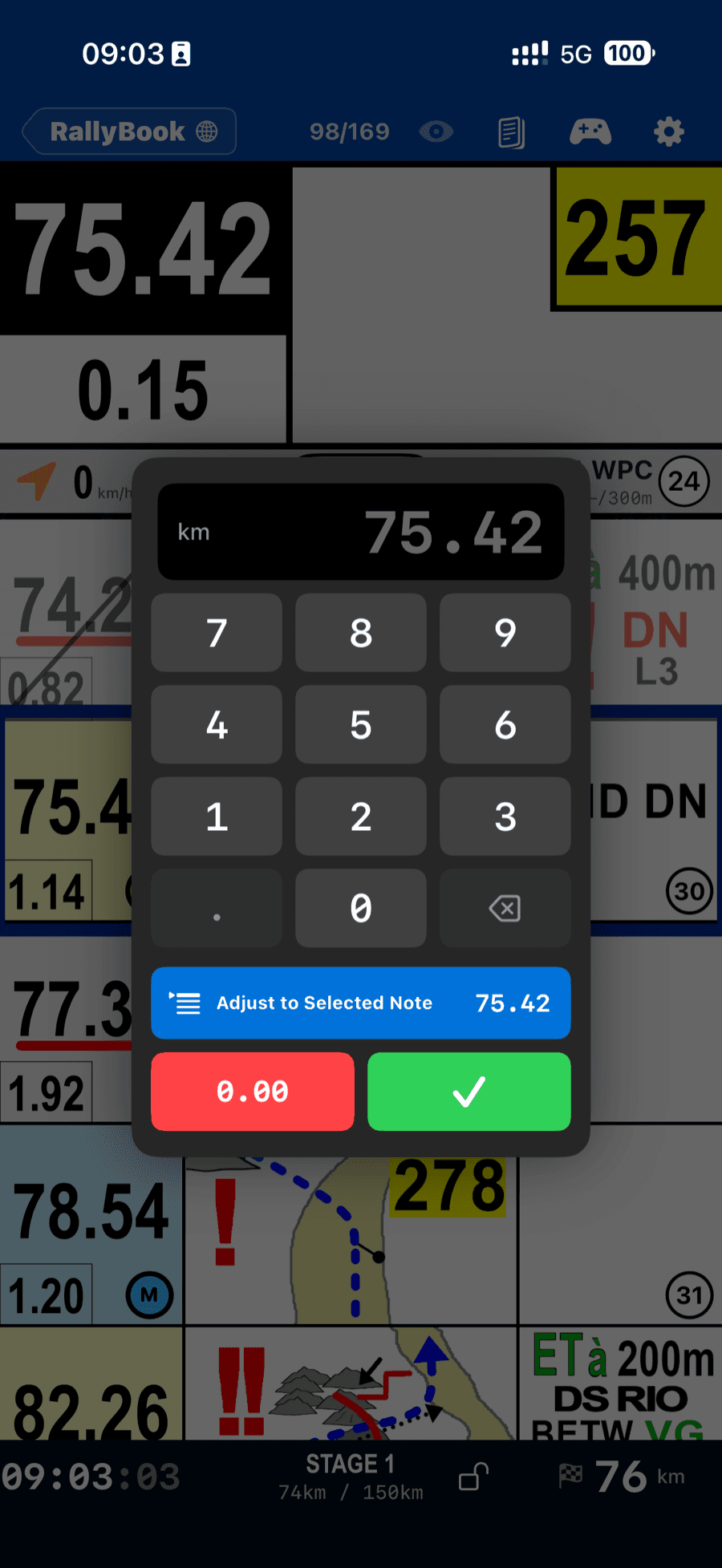
Total and partial, adjustable on the move. A roadbook is only as good as the odometer you read it against, so correcting it has to be quick enough to do while riding.
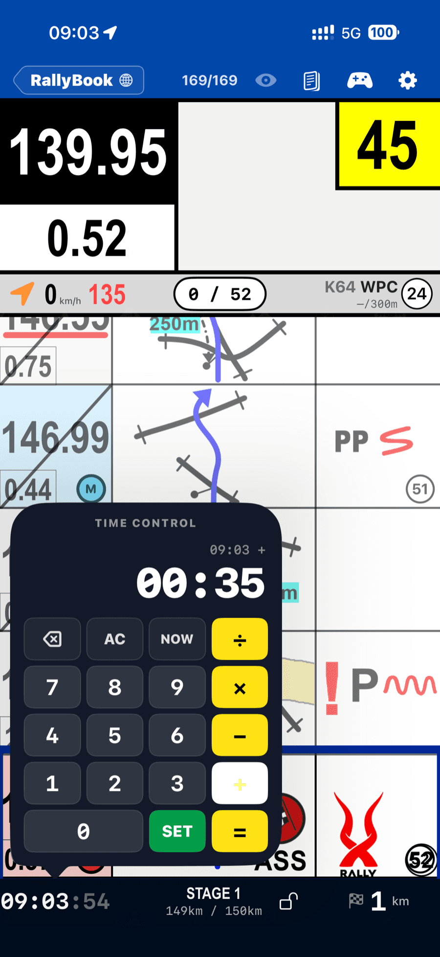
Speed zones
Real-time speed-zone monitoring
DZ and FZ zones are tracked live, with a warning as you approach the limit and an alarm past it. Zones come from the roadbook, so the limits are the event's own.
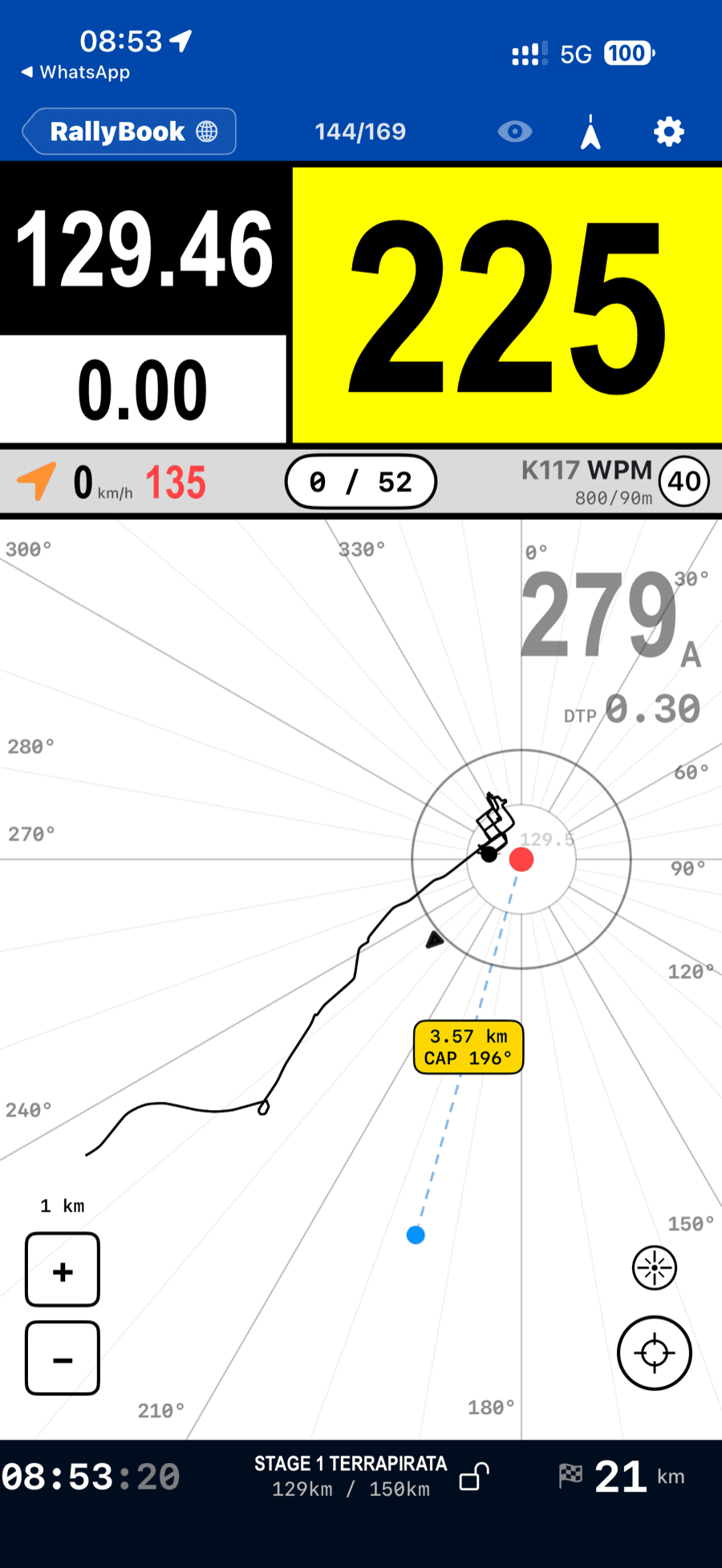
GPS and trace
Position, path and waypoints on one map
Live GPS with the trail behind you, waypoint markers and validation radii. It is also the recording that feeds your Analysis Report once you finish.
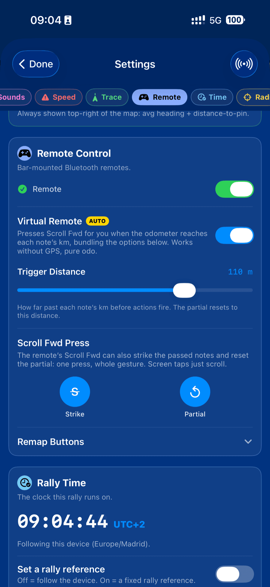
Remote control
Navigate without touching the device
Scroll the roadbook, adjust the odometer, select waypoints and lock the screen from a handlebar remote. Buttons are remappable, so the remote you already run keeps the layout you already know.
Offline
Designed for where there is no signal.
Download at the bivouac and everything works from there: roadbook, validation, zones, odometer, map and recording, with the device in airplane mode. Two hundred kilometres from a tower is the normal case in this sport, not the exception.
Your library
Your roadbooks follow your account.
Sign in with Apple, Google or email and your stages are there: on your phone, your tablet, and a replacement device after a crash. Events you have ridden stay as history.
Get it
Ride your first stage on it.
Free to ride any event you're invited to, and free to browse the public catalog. Pro opens your own files for training on your own.
RallyBook isn't on the app stores yet. Write to us and we'll get you a build.
hello@rallybook.app